Drive over any bridge in Portland right now and you'll notice the Willamette River raging much nearer your vehicle than usual.
Related: Swelling Willamette and Columbia Rivers Could Flood Parts of Portland This Weekend
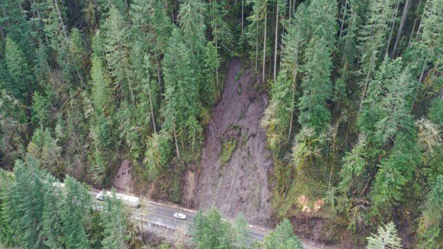
Heavy rain in the northwest part of Oregon has caused the Columbia and Willamette Rivers to swell, and in some places the downpour has led to landslides that shut down highways.
The Oregon Department of Transportation says its crews have been busy clearing debris from roads near Eugene, Corvallis, Bandon and in Eastern Oregon.
Tweets from the agency show massive logs being scraped from roads with trucks, water covering multiple highway lanes and huge chunks of asphalt disappeared into sinkholes at various highways around the state.
Crews have been busy clearing out hazard trees and assessing the hillsides along OR 58 after this week’s earlier landslides. Please continue to be on the lookout for workers & equipment in the area, & plan ahead for delays. pic.twitter.com/ikhYmML8EP
— Oregon DOT (@OregonDOT) April 12, 2019
30-hour timelapse from @OregonDOT highway cam images shows Willamette River receding from Hwy. 34 at Peoria Road. #flooding
— J. Heasly (@jpheasly) April 11, 2019
Story here: https://t.co/ulT8L731Nc pic.twitter.com/fxktOrJbFs
OR 42S remains closed five mi east of #Bandon at MP 5.4 after a 50 ft. section of the roadway collapsed last night. This closure will likely extend into next week. Motorists traveling between Bandon & #Coquille are advised to use US 101 & OR 42. pic.twitter.com/yiHw07ZQEd
— Oregon DOT (@OregonDOT) April 11, 2019
In the Columbia River Gorge, rockslides caused by changing weather and scorched landscapes have also led to the closure of the Wahkeena-Multnomah loop trail at Multnomah Falls.
Oregon travelers headed toward more water-logged places can check for updates on highway closures here.
