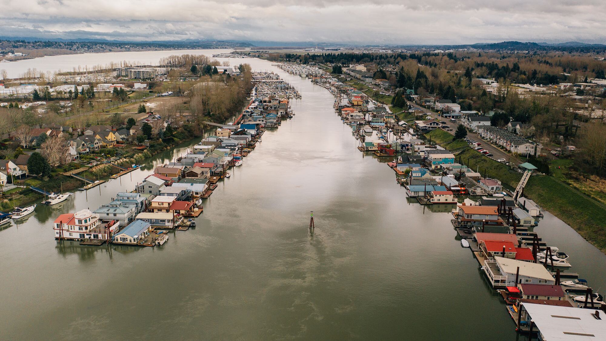
On top of the levee in Bridgeton, the smell of river mud is strong. Canada geese honk over the thrum of traffic on the Interstate 5 Bridge a half-mile downstream.
Life is peaceful in Portland's least populous neighborhood—it has fewer than 1,000 residents—but that's all about to change.
Tom Hickey is chairman of the Bridgeton Neighborhood Association and, like many of his neighbors, a resident of a floating home. He's fighting what could become the local equivalent of the Berlin Wall.
What worries Hickey: a $158 million federal plan to strengthen 27 miles of levees that keep Portland from being inundated by the Columbia River.
Part of the plan would put a 3-foot retaining wall down the middle of Bridgeton's main street. That street is built directly on top of the levee, a 36-foot earthen berm. Portions of the street and parking spaces to the north are considered unstable and would be walled off under the plan to buttress the levees.
"It's a death knell to the culture of the people who live in the community," Hickey says. "We're looking at a loss of access to the water and a major loss of property value."
Countless words have been penned about the potentially catastrophic effects of a Cascadian subduction zone earthquake on Portland. Far less attention has been devoted to the threat of Columbia River floods—which happen far more frequently and are a danger accelerated by a warming planet.
Last month, the federal government released its latest plan to deal with that threat. It's a project that would change the face of this city. Yet Portlanders remain deeply divided over what that project should look like.
"Sure, there are a lot of questions," says Corky Collier, executive director of the Columbia Corridor Association, which represents hundreds of businesses protected by the levees. "But can we afford not to do it?"

Torrential flooding in Pendleton and surrounding areas this week took one life and changed others irreparably. It's a reminder of the destructive power of rising water.
Portland has its own memories of that force. Vanport, just southwest of Bridgeton, was completely wiped out in 1948, when floodwaters breached a railroad embankment that is part of the levee system, causing 15 deaths and the displacement of 18,000 people.
That was one of Portland's five "100-year floods" in the past 125 years. After the catastrophic flooding from Hurricanes Katrina in 2005 and Sandy in 2012, the feds investigated other key levee systems around the country. Few systems are more economically important.
Portland's levees, which stretch from the BNSF railroad bridge across the Columbia to the mouth of the Sandy River, date from 1917. They protect an enormous range of assets, including the homes of 7,500 people, the region's largest concentration of industrial and warehouse jobs, sections of three interstate highways, and Portland International Airport.
In January, after three years of investigation, the U.S. Army Corps of Engineers, which maintains federally regulated levees, produced a range of five options for Portland's levees, from doing nothing to spending $158 million to shore up earthen walls, raise the height of existing barriers, and replace decrepit pumps to bring the entire system into compliance with Federal Emergency Management Agency standards.
The benefits would be twofold: protecting assets from what even the Corps of Engineers says is likely to be more frequent and destructive flooding because of climate change, and allowing property owners protected by the levees to continue to qualify for federally subsidized flood insurance.
Collier is excited about the plan.
"The way it's set up, the feds pay two-thirds—that's a great deal," he says. Collier acknowledges the plan would require local cleanup of polluted lands before the Corps does its part. But he says that's long overdue.
"The CCA's been working on brownfield cleanup for 15 years and it's really frustrating," Collier says. "Let's get on with it."
Bob Sallinger, conservation director of the Audubon Society of Portland, takes a different view. Sallinger says the Corps' plan, which he calls "a train wreck," would result in the loss of trees and other habitat and doesn't give sufficient consideration to natural solutions like returning large swaths of floodplain to wetlands.
"This looks like a document written 25 years ago," Sallinger says. "They just want to build larger, taller walls without regard to the health of the environment."

Valerie Ringold, chief planner for the Corps, insists that's not the case. She says the Corps evaluated letting a major portion of the land protected by the levees return to natural floodplain and determined it wouldn't lessen flood risks. The Corps, she adds, would replace any vegetation it destroys and mitigate any damage to wetlands.
Michael Jordan, director of the city of Portland's Bureau of Environmental Services, has monitored the Corps' investigation closely. He says the city wants to ensure the levee fix accomplishes as many goals as possible—safety, environmental and recreational—and adds he's confident that can happen.
"The risks people have identified are manageable," Jordan says. "There are greater risks of not doing the project."
Hickey is hopeful as well. He met with Corps project manager Laura Hicks last week to discuss a retaining wall design that has been used elsewhere: one with removable sections that could be stored until water approaching Portland rises, then snapped into place.
His suggestion will be among many public comments the Corps receives in a process that is open through Feb. 14.
"Climate change is real and we agree the levees need to be improved," Hickey says. "The battle is whether they suffocate our neighborhood, or enhance it.
*Correction: this story originally said the Vanport flood occurred when the Columbia River "spilled over the levee Bridgeton is built on." In fact the flood occurred when a railway embankment failed. WW regrets the error.
