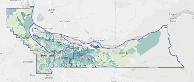
The Mulnomah County auditor has redrawn the districts for the county board of commissioners. Squint and you might notice the changes.
It hasn’t attracted the partisan rancor of redrawing Oregon’s congressional or legislative boundaries, because everyone in Multnomah County is a Democrat*, but county officials are also obligated to adjust the districts of elected officials based on population totals in the 2020 census.
On Oct. 28, County Auditor Jennifer McGuirk released draft maps for the four county commission districts. Residents have until Nov. 19 to provide feedback.
The most striking aspect of the maps is how little has moved. McGuirk says that’s because she’s obligated by county charter to keep the borders as unchanged as possible.
“Multnomah County redistricting is free from gerrymandering,” she writes. “Commissioners are elected on a nonpartisan basis, so there is no built-in temptation to draw districts to favor a political party. Also, the charter requires maintaining the general geographic characteristics of the existing districts, which prevents significant boundary changes other than to attain population equality.”
The maps push the borders of Districts 3 and 4 westward. That suggests that population gains in central Portland have outpaced those in east county over the past decade. It also means the people most likely to see their elected official change are living on the Northeast Portland border with Gresham, or in Eastmoreland.
The Portland City Council doesn’t have to undergo a similar process, because all five commission members are elected citywide. But lots of good-government reformers are eager to change that system—which means a much higher-profile debate is coming to City Hall next year.
Here are the proposed new boundaries. (Changes are in light blue; the old borders are in orange.)

*This is a joke. Did you laugh? We hope you laughed.
