The city is amid a massive overhaul of its form of government and how it elects its leaders. That’s because Portlanders overwhelmingly passed a sweeping ballot measure last year that makes three critical changes to our government: It scraps political control of bureaus and places a city administrator in charge of civic functions while a 12-member City Council makes policy; it splits the city into four geographic voting districts; and council members representing these four districts will be elected using ranked-choice voting.
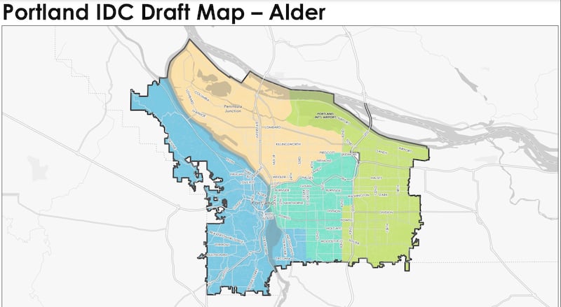
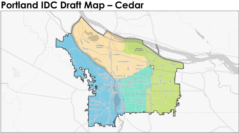
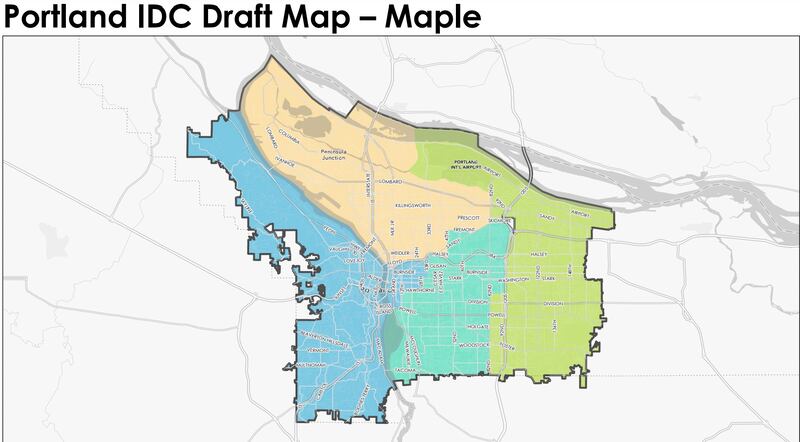
On Thursday, an independent citizen advisory body released three possible maps of the voting districts. One of these three maps will determine in which voting district Portlanders will cast their ballots in 2024.
The charter measure required that the commission draw maps that keep communities “of common interest” together, not bifurcate existing political or geographic boundaries (such as freeways and major thoroughfares), and draw districts of equal population.
After hearing public testimony, the 13-member commission will vote to select a map in August. If nine or more commissioners approve a particular map, the decision is final.
The three maps are broadly similar. All three keep the westside and outer East Portland as distinct voting blocs, and bunch North and inner Northeast Portland together. The differences lie in where the boundaries fall: Should Sellwood be lumped in with the westside, for example, or should the Central Eastside join that district instead?
Below are the three possible maps.


