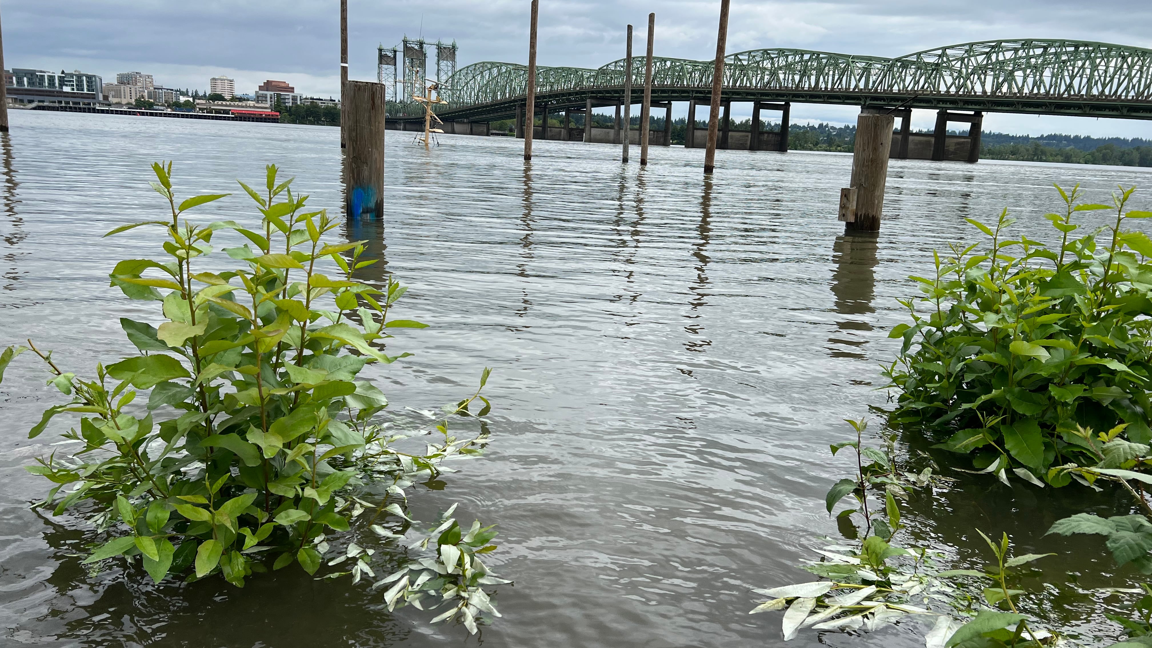
After a weekend deluge, it’s not just swimming in Oregon rivers that’s treacherous. Portland authorities now urge caution when walking near the banks of the Columbia River.
The National Weather Service issued a flood warning Monday morning for the Columbia. Between Friday morning and Monday afternoon, the river rose 3.1 feet: from 13 feet to 16.1 feet. The river reaches minor flood status at 16 feet.
The portion of the river most in danger of flooding is from Sauvie Island to Washougal, Wash., although only in unprotected areas, according to NWS hydrologist Andy Bryant.
“The flooding is confined to areas that aren’t protected by levees, so it’s mostly trails and parks and natural areas that are directly adjacent to the river,” Bryant tells WW.
To minimize damage from flooding, the Multnomah County Drainage District—responsible for operating and maintaining flood management systems along the Columbia Slough and lower Columbia River—began “enhanced operations” on June 10, according to a statement released Monday. Such operations include the monitoring of water levels, inspection of levees, and communication with property owners who live in low-lying floodplains.
The MCDD is also collaborating with Cascadia Behavioral Health to communicate with individuals camping in high-risk areas and is coordinating with the U.S. Army Corps of Engineers dam operations team until the high water recedes, the statement said. The district recommends that riverside homeowners and marina operators secure any loose items to avoid damaging levees.
Bryant described the rainfall in the Pacific Northwest the past few days as “unusually heavy” for mid-June, but characterized the timing of the Columbia’s high water levels as typical given seasonal weather patterns.
“The water that usually leads to flooding on the Columbia is usually snowmelt and rain combined this time of year,” Bryant tells WW. “It’s the typical time of year for it to flood. That said, it doesn’t happen every year, and it’s been since 2019 that we’ve had it this bad.”
Although Portland received record-setting amounts of rain this weekend, only the Columbia is in danger of flooding because it received water from tributaries throughout the Columbia watershed, Bryant tells WW.
Other rivers, including the Willamette, are still running high, and trails in low-lying areas like Oaks Bottom and Sellwood Riverfront Park were underwater today. Local officials advise not to walk in such spots. Not that you’d be tempted:
Flooding at Sellwood Riverfront Park. A beaver swam up to the picnic table and took a rest. pic.twitter.com/G6gpiyjbQc
— Chuck Slothower (@chuckslothower) June 14, 2022
The NWS forecasts a maximum water level of 16.1 feet for the Columbia on Tuesday morning. The flood warning remains in effect through early Wednesday afternoon.