To state the obvious, islands capture the imagination. Whether it’s the lure of hidden booty on Treasure, fulfilling the ultimate bucket list on Fantasy, or finding out what you’re made of (see Gilligan, the Swiss family, and that Tom Hanks movie), being surrounded by water holds enduring appeal.
We aren’t the first to notice this. Since time immemorial, humans have sought out islands for their shelter, their strategic location (all the water, some of it potable!), and their built-in protection against invaders.
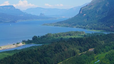
The Columbia River boasts islands by the hundreds, possibly even thousands, each with its own personality. Sauvie Island feels like a rustic village. Hayden Island boasts big-box retail and a McDonald’s. Memaloose Island is a traditional burial ground for Indigenous people. Chicken Charlie’s Island (also known as Eighteenmile Island) is a lone chunk of rock with a single house. It’s occasionally for sale; check Zillow.
The Columbia created these islands, and in many ways they reflect the mighty river’s character. They’re in constant flux, scoured by the braiding currents, sometimes built up, sometimes worn away. Like the river, they have been shaped by human engineering: created by dredge spoils, enlarged by levees, protected by dikes, or drowned by dams. And like us, they straddle the worlds of water and land.
We’ve highlighted a selection that are especially rewarding to explore. These islands offer a wealth of opportunities to experience the river in all its myriad forms, from urban waterway to technical marvel to party spot and peaceful natural wonder. Choose your own adventure or make it a summer project to visit them all.
Clover Island

- Location: Downtown Kennewick, Wash.
- River mile: 329
- Size: 16 acres
- Access: Causeway
- Fun fact: Ice Harbor Brewery is the OG microbrewer in the Tri-Cities.
Cross under the “Welcome to Clover Island” gateway and you’ve arrived. Clover is the most upstream and urban of the islands we explored, but you’ll still soak in the get-away-from-it-all vibe.
A mere 16 acres today, Clover Island was once 10 times larger and part of a cluster of five small islands known as Ánwaš (sun’s place) to the Wánapum people who have lived here for generations.
Lewis and Clark paddled past the island in 1805, a visit recognized at the lovely Sacagawea Historical State Park, just a bit west in Pasco, where the Columbia and Snake rivers converge.
In 1953, the McNary Dam raised the river level and flooded most of the island. The Port of Kennewick reshaped the land for cargo traffic, but the docks eventually fell into disrepair. In 2008, the port and community partners began to transform an industrial eyesore into a destination waterfront. Amenities now include the Clover Island Riverwalk, public art, restaurants, and the proudly independent Clover Island Inn.
Many of the hotel’s pleasant rooms boast incredible views; a seasonal pool and hot tub sit on the water’s edge. There’s a boat launch if you choose to arrive afloat.
The hotel lends bikes so guests can explore the short trail that connects to the 24-mile Sacagawea Heritage Trail, which winds through Kennewick, Hanford, and Pasco, hugging the river. Check out the giant sculptures of sapáxikas, willow fish traps that Native Americans used to catch salmon.
There are two restaurants on the island: a brewpub (natch, Ice Harbor) and Cedars, which feels like the place you would have gone for dinner before your prom in 1990. Relive that experience by visiting during the island’s summer concert series. And now you’re an adult: Get a room.
Plymouth Island
- Location: Plymouth, Wash., across the river from Umatilla, Ore.
- River mile: 290
- Size: Over a mile long
- Access: Causeway. There’s also a boat ramp.
- Fun fact: More than 30 cities and towns in the U.S. are named Plymouth.
Drive through the tiny river town of Plymouth, Wash., turn onto the causeway leading to Plymouth Island, and you know you’re heading somewhere special.
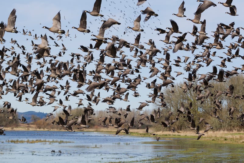
Plymouth Island was once home to an ancient village known as Soloosa and holds cultural significance for the Confederated Tribes of the Umatilla Indian Reservation. The island has a desert vibe: The air is rich with sage and juniper, sweet and dusty. As you walk down to the water, the shoreline is thick with birdlife and the vast river stretches toward the horizon. The only things you can hear are the calls of birds and the endless lapping of water on the rocky shore.
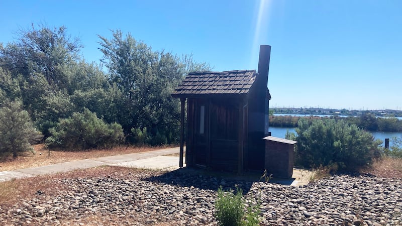
Plymouth is the perfect place to launch a kayak or a canoe and spend a languid afternoon exploring inlets and waterways, well hidden from the madness of civilization. There’s a surprisingly quaint outhouse (pictured).
You can’t camp on the island, but on the Washington shore, just slightly to the west, you’ll find a campground operated by the U.S. Army Corps of Engineers, with 32 shady sites at the water’s edge. Another fun fact: The Corps maintains more than 94,000 campsites nationwide.
Wells Island
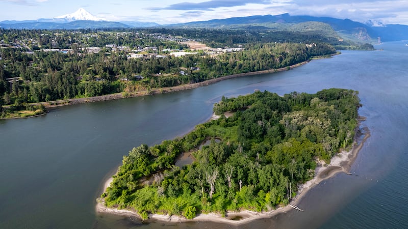
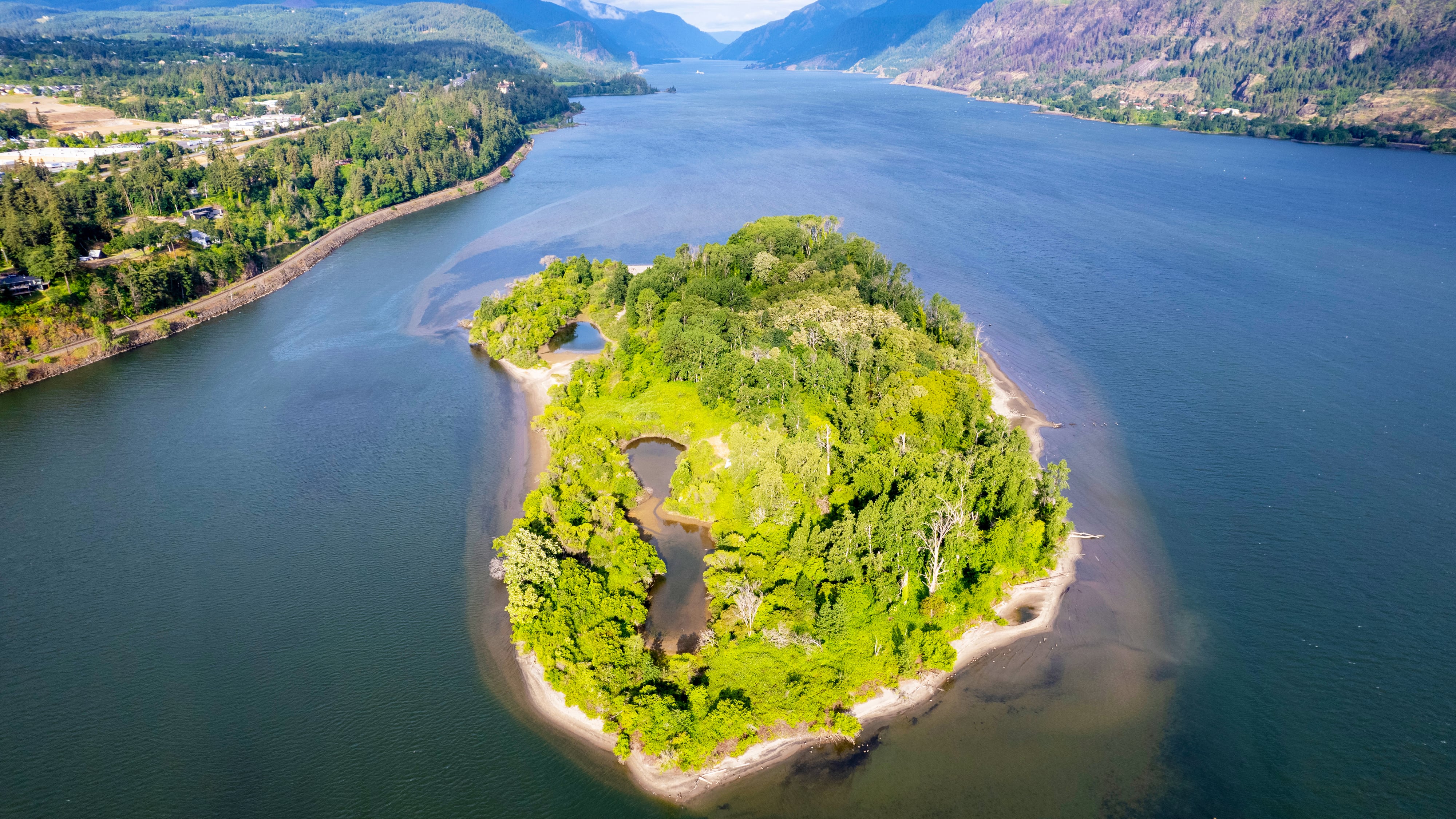
- Location: Hood River, Ore.
- River mile: 167
- Size: Half a mile long
- Population: Day-tripping windsurfers, kayakers, and paddle boarders
- Access: Easy, quick paddle
- Fun fact: Was called Morrison Island until bought by Dr. Stanley Wells. Now owned by the Port of Hood River.
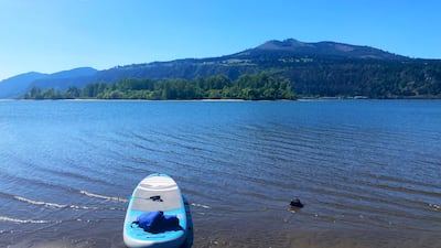
Drive past the swim beach, the buzzy restaurants and brewpubs, and the distillery on the Hood River waterfront, until you reach The Hook. This narrow finger of land curves into the river, creating Wacoma Basin, a protected spot to get the hang of windsurfing and paddling. The Hook is also an ideal launch spot for an expedition to Wells Island.
On a placid day, Wells beckons, sparkling in the afternoon sun, barely two football fields away. After a 10-minute downstream paddle, you’ll reach the shore and find a sandy beach decorated with animal tracks.
The island is surprisingly verdant and dense with trees. You can forge a path through or around the peaceful interior to reach the sunnier beaches facing downstream and the Washington side. On the island, there are old structures to explore. (Tread lightly and bring mosquito repellent.) Paddle downstream to the far west end, where you may find a private beach to unleash your inner Ginger or Mary Ann. As always, river currents may be strong and unpredictable, so wear a life vest, know what you’re doing, and pay attention to hidden obstacles. The Hook offers parking, restrooms, and a place to hose down your craft.
Thunder Island
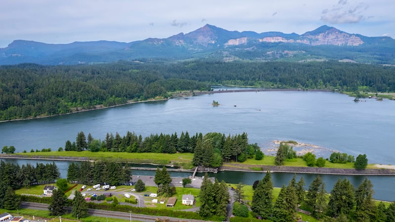
- Location: Cascade Locks, Ore.
- River mile: 149
- Size: Less than half a mile long
- Access: Footbridge
- Fun fact: You can rent the island for weddings or a Survivor-themed party.
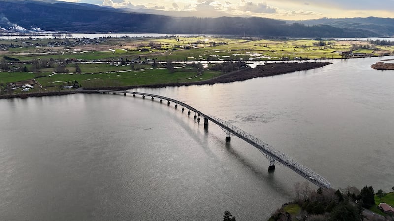
Thunder Island was created in 1890 by the construction of the Cascade Locks, which allowed ships to skirt the raging rapids. The island got its name from their roar. But in 1938, Bonneville Dam swallowed those rapids, and they thunder no more. Still, the river unleashed its submerged power last January during an intense winter storm, ripping the nearby Sternwheeler from its moorings and nearly smashing the island’s footbridge to bits.
The bridge has been repaired and reopened, and on a sunny day, Thunder Island is a quiet, peaceful setting ideal for gatherings of any size. The island boasts a wealth of trees for shade and selfies, picnic tables and plenty of well-kept grassy nooks for taking in the views from a blanket—including the Bridge of the Gods. Even though it’s just steps from the mainland, you will feel like you actually went somewhere.
On shore, where there’s plenty of parking, you can see the Oregon Pony, the first steam locomotive built on the Pacific coast. It’s next to the Cascade Locks Historical Museum in an original locktender’s house. For refreshment, head to nearby Thunder Island Brewery in Cascade Locks.
Sand Island I
- Location: Rooster Rock State Park, 2 miles east of Corbett, Ore.
- RIver mile: 131
- Size: Over a mile long, the island fluctuates with the river level but has plenty of space to spread out and get comfortable.
- Inhabitants: Bare-naked people
- Access: When the tide is right, wade across from the Oregon shore.
- Fun Fact: The Chinook called the Rooster Rock monolith iwash, meaning penis. Settlers translated that into “Cock Rock.” Early mapmakers decided it would be more appropriate to call the basalt protuberance after the cock that crows.
Take your sandals, but leave your knickers behind. This Sand Island (there are at least five Sand Islands in the Columbia) lies languid along the clothing-optional stretch of Rooster Rock State Park. Disrobing is your choice, but given the vibe, we suspect you’ll feel more comfortable with your clothes off than on. Nudity is a great equalizer.
Plan on at least 15 minutes to hike from the parking lot to the water’s edge and definitely keep your shoes on! The trail winds through a strange landscape of stunted trees—hardy survivors of the 2017 Eagle Creek Fire that ravaged the Columbia Gorge. Branches form a lush canopy, with the echo of woodpeckers and sweet bursts of honeysuckle.
Shaped like a stingray with its tail pointing west, Sand Island is a dramatic sweep of sand, sculpted into exquisite dunes by wind and water, sheltered by a stand of trees on the eastern end. When the water level cooperates, you can wade across on a sandbar at the western tip. Bring a waterproof bag for any stuff that can’t get wet.
You can also reach the island by boat. There’s a ramp at Latourell Creek at the west end of the park, but the island is a long way upstream for paddlers. If your craft is light enough, consider hauling it down the steps near the ranger station and putting in there.
Once you’re safely ashore, hunt for the perfect spot to wiggle your toes and other body parts in the sand, feel the breeze on your skin, and let it all hang out. Sand Island is welcome to everyone, and attracts many along the LGBTQ+ spectrum. Bring an open mind and a minimal wardrobe, and be on the lookout for magic.
Reed Island
- Location: Washougal, Wash.
- River mile: 125
- Size: 427 acres
- Inhabitants: Eagles, herons, beavers
- Access: Boat
- Fun Fact: Sam Reed, Washington’s Secretary of State from 2001 to 2013, is a direct descendant of the island’s original homesteaders.
The typical way to get to Reed Island is to put in at the boat ramp at Parker’s Landing in Washougal. That has the advantage of being next to the Puffin Cafe (page 58) in case you want a margarita or fish tacos before or after your voyage.
But if you’re paddling, that means an upstream haul of almost 3 miles before you reach the island’s western tip.
For an easier journey, carry your craft from the parking lot to Cottonwood Beach in Washougal (which is also great for swimming). From there, you can reach Reed Island after about 20 minutes of paddling; the currents can be strong, but on a calm day it’s an easy cruise. The western tip of the island is wild, fortified by thick marsh grass and wicked snarls of fallen trees spilling into the river like an upturned box of matches. You’ll need to paddle farther east before reaching a stretch of bank wide enough to pull up.
The signs of erosion are no coincidence. Like many river islands, Reed Island is constantly shaped by the ceaseless currents of the Columbia. In 1885, it was bought by homesteaders William and Myrta Reed, who raised a family here. The family gave the island to the state of Washington in 1954 after their home was flooded; it’s now a state park open to day use.
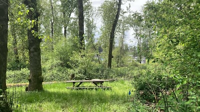
The eastern half of the island is sheltered and sandy, and features picnic tables and trails. On a gorgeous late spring evening, there was not a single other watercraft or human as far as the eye could see. But wildlife was everywhere: eagles, herons, ducks; the unmistakable traces of beaver in the chiseled point of a log.
Government Island
- Location: Under the Glenn Jackson Bridge of I-205
- River mile: 118–111
- Size: 1,760 acres, about 7 miles long
- Inhabitants: Turtles, bats, herons, otters, bald eagles
- Access: Boat
- Fun Fact: If you’re lucky, you’ll spot a Columbian white-tailed deer. This subspecies, named for the river, was federally listed as endangered in Oregon and Washington in 1967.
Thousands of people pass over it every day as they drive across the Glenn Jackson Bridge. But they can’t stop; there’s no off-ramp. Thus Government Island eludes the madding crowd, an emerald enigma dwelling in splendid isolation, surrounded by a mighty moat.
Seven miles long, shaped like a swimming beaver, Government Island feels like a lost domain. Native people lived here for millennia, hunting, fishing, and farming. Lewis and Clark camped here in 1805 and named it Diamond Island. For a while, the U.S. Army used it as a pasture for horses. Later, it was home to family farms and a small schoolhouse. But many structures were destroyed by the Great Flood of 1894. The Port of Portland bought the island in 1969 with plans to expand the airport (which never materialized).
Getting here isn’t easy. We paddled a canoe across from the boat ramp at Chinook Landing, near Blue Lake Park in Troutdale, but had to fight strong currents and steer clear of wing dams. Once you arrive, you can tie up at two docks on the north shore or pull up on the sand.
The island is both wild and serene. The perimeter is girded by an imposing forest, thick with willow and cottonwood, blackberry vines, and stinging nettle. The interior is home to several rare wildlife species—don’t explore unless you have a special permit. At the water’s edge, the island offers a mind-boggling 15 miles of sandy beaches, perfect for picnics or sunbathing. Camping is allowed below the vegetation line. On the north shore, Bartlett Landing (named for a homesteading family) features composting toilets. At the western tip, you’ll find Lemon Island (technically separate, although the two are contiguous at lower water levels.) South lies McGuire Island; look out for river otters.
Bachelor Island
- Location: Ridgefield, Wash.
- River mile: 88
- Size: Over 3 miles long; about 2,000 acres.
- Access: Bridge (not always open) or boat
- Fun Fact: The current name refers to three unmarried men who settled on the island around 1850. Before then, the island had been called Quathlahpotle, Pasainks, Green Bryor, and Columbia Island.
If you’re skeptical that birds are a worthy attraction, we invite you to make your way to Bachelor Island. This marshy sprawl is part of the Ridgefield National Wildlife Refuge, and it literally teems with winged creatures. On a recent visit, the sky was so thick with flapping wings and eerie cries, we were scared to get out of the car lest our feathered friends decide en masse to reenact that old Hitchcock movie. In fact, it’s not encouraged to get out and wander, beyond a few trails that are open seasonally (don’t want to disturb the nesting cranes!) and a viewing blind. Local birdwatchers have spotted as many as 250 species here, from the warbling vireo to the sharp-shinned hawk. By car, you make your way through the refuge on an self-guided auto tour (download the podcast that describes what you’re seeing at well-marked stops).
A short, narrow bridge connects the island to the shore, but it is often closed. To reach the sandy western side of the island with its fine view of the big ships plying the Columbia, put in your vessel at the Ridgefield boat ramp and paddle along the lazy Lake River. The eastern side is strictly for the birds. This is their domain. We’re just visitors.
Sand Island II
- Location: St. Helens, Ore.
- River mile: 86
- Size: 32 acres
- Access: Boat
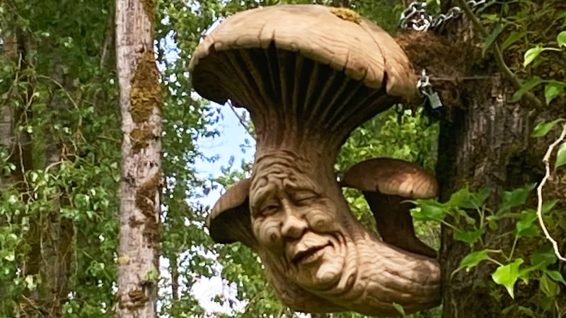
- Fun fact: Look out for Bigfoot. A local artist has “hidden” sculptures in trees around the island.
Downstream from the confluence of the Lewis River, a cannon’s shot from St. Helens, lies a pirate’s dream: Sand Island. (Yes, another island named for sand.) Shaped like a crystal of quartz, the island is the fortuitous result of a government project to deepen the shipping channel by dredging sand from the riverbed. That sand had to go somewhere, and that somewhere is Sand Island.
The island is now a well-kept, privately managed campground; book in advance at sandislandcampground.com. The hosts operate a river shuttle to haul you and your gear back and forth from the marina at St. Helens, where you can stock up on supplies. While in port, check out the Skagit Chief, an old tugboat that’s been kitted out with a deck and converted to a salsa dance floor.
Despite its relative youth, the island is thickly forested and alive with birdsong. On a recent visit, we stumbled on a nest of rabbits and a scattering of white-tailed deer. (Something we didn’t know: Deer can swim.) The campsites include picnic tables and fire pits, but no running water. The toilets are the composting type; you can shower at the marina if a swim in the river isn’t enough for you. Surprise amenities: horseshoes, cornhole, and a 12-basket disc golf course. Best of all, the island is girded by long sweeps of beach crowned with purple wildflowers. Spread your towel and drink in the majestic views of the river.
Puget Island
- Size: 4,785 acres
- River mile: 46–38
- Access: From Washington, drive over the bridge at Cathlamet. From Westport, Ore., the Wahkiakum Ferry runs every hour on the quarter hour; call 360-795-7867 to verify.
- Inhabitants: 831 people, several churches, cows, deer, geese
- Fun fact: Puget Island offers access to a bonus island called Coffee Pot.
Braided by tidal channels, Puget Island is a beguiling landscape of farm and field, dike and slough, where the honk of geese echoes across the ceaseless moods of the river. The island (really a clutch of four islands) is connected to the Washington side by a two-lane steel truss bridge; on the Oregon side, the Oscar B ferry churns to and from the little town of Westport.
Surprisingly, this island is home to almost a thousand people, which makes it the biggest community in Wahkiakum County, boasting farms, churches, houseboats, a deer refuge, and a Norse Hall (Puget was once known as Little Norway).
The First Lutheran Church (on Welcome Slough, not the main road) was originally a cookhouse in a logging camp named New Jerusalem on the Oregon shore. They floated it over to the island on logs. Don’t miss the Little Island Creamery for brie, curds, and butter, and check out the hexagonal nursery at Puget Island Gardens for the gardener in your life.
Most of the island is private land, but you’ll find two public beaches. Svensen Park features a boat ramp, picnic tables, and a short stretch of sand. For boaters, this is an ideal launch for intrepid explorers aiming for the uninhabited Coffee Pot Island just across the channel. The Washington Department of Fish and Wildlife maintains another beach access at Pancake Point. The beach here is wider and filled with driftwood burls carved into fantastic shapes by wind and water. Great place to lie on the sand, fish off the docks, and watch the giant ships plying the Columbia.
You can also access the water from the Westport Boat Ramp and Jones Beach on the Oregon side. (As always, beware of the omnipresent hazards of boating on this stretch of the Columbia: wing dams, currents, tides, shipping, and wind.)
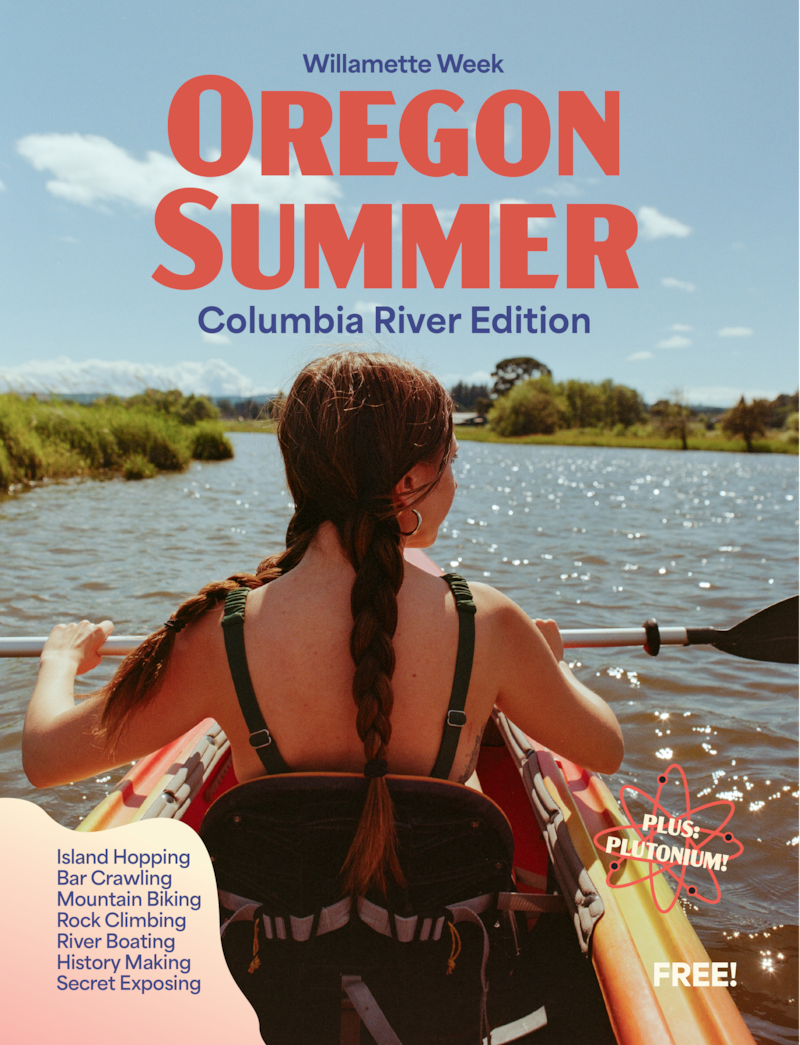
This story is part of Oregon Summer Magazine, Willamette Week’s annual guide to the summer months, this year focused along the Columbia River. It is free and can be found all over Portland beginning Monday, July 1st, 2024. Find a copy at one of the locations noted on this map before they all get picked up! Read more from Oregon Summer magazine online here.