A few disclosures: I don’t own a Sprinter van; I don’t know the tooth count on my mountain bike chainring; I hold no King of the Mountains on Strava, except for going up my driveway in Northeast Portland.
But I’m a longtime bike commuter, and I’ve ridden a fair bit in the Columbia River Gorge, often returning like a Wind River salmon to the same old places. I ride road and mountain bikes, and like everyone these days, I covet a number of gravel rigs.
To develop these suggestions, I reviewed my Strava, and talked to some top-notch sources. This isn’t a “best of” list because, like “best pizza” and “best burger” lists, bike trails are a matter of taste. These are some terrific choices for a day in the Gorge. There are many, many more.
Mountain Biking
Post Canyon (Spring, Summer, Fall)
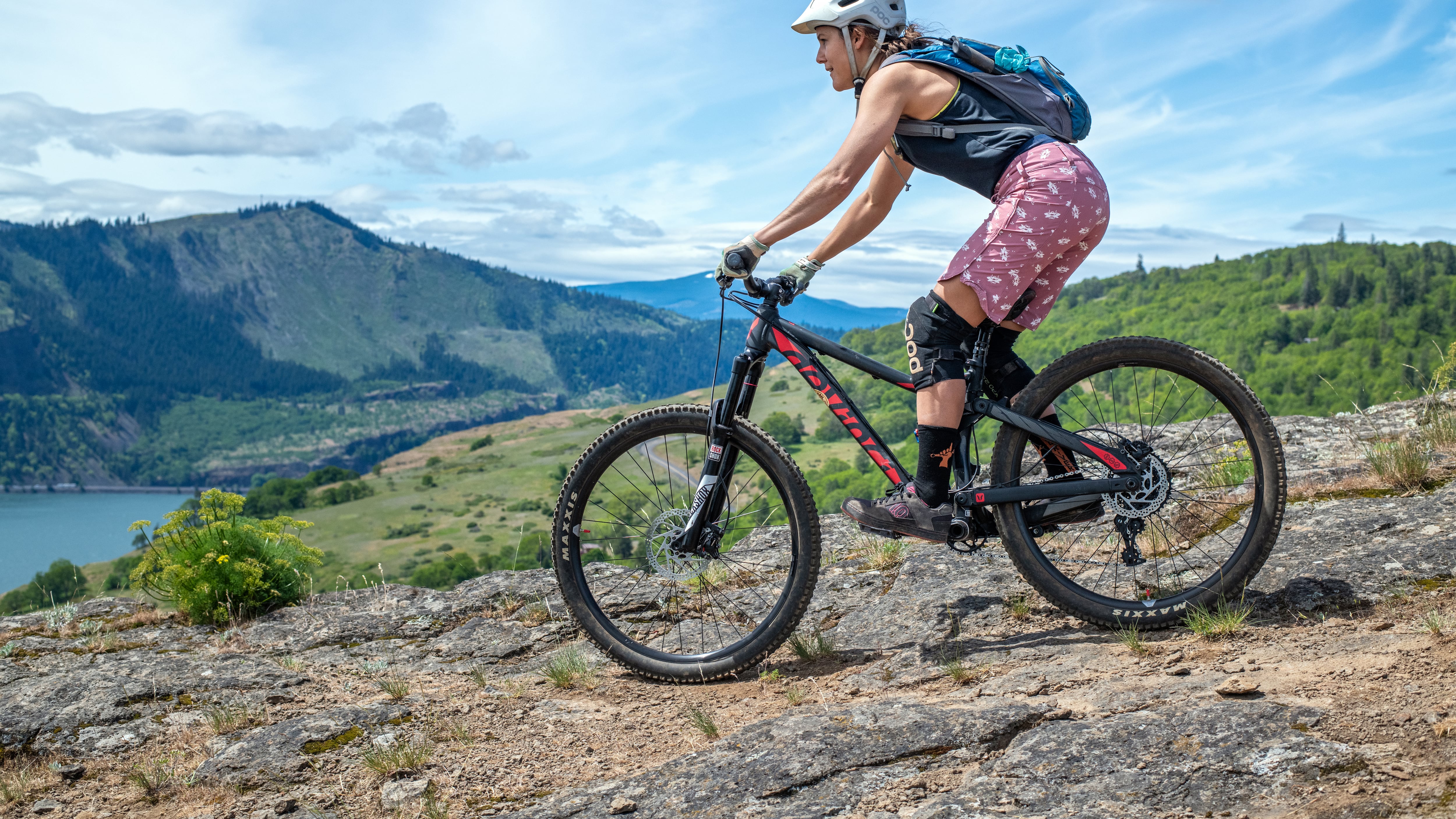
Imagine the Disneyland of mountain biking. That’s Post Canyon, a network of trails cut out of the Hood River County Tree Farm, west of Hood River. There are rides for kids and there are big sketchy roller coasters. Like ski runs, the trails are rated for difficulty.
Post Canyon has always been amazing, but it’s even better now. They’ve added ramps and jumps, and slick signage. Family Man, the ideal place to learn how to mountain bike or to teach your kids, has been buffed up with jumps, ramps, and small berms.
There are new expert trails, too. A-Side opened this year. It winds through the forest at a knuckle-whitening pitch. It was cut by hand (without machines, like most trails are) by the Hood River Area Trail Stewards, or HRATS, the volunteer group that works with Hood River County to build many of the trails. My mountain bike doyen, Ben Fischler, called it “feral,” and that’s spot on. The dirt is soft and loamy, and trees and bushes brush by your handlebars.
“There’s a lot of very active 30-to-60-year-olds out here who don’t want to be in the air,” HRATS president Tim Mixon says. “But they want an expert trail. That’s A-Side.”
The big crowd-pleaser is Grand Prix, a high-speed racetrack that runs down through the trees with big banked turns and optional jumps. If you like going fast and getting sideways to the ground on bermed turns, you’ll love it.
The best way to experience Post Canyon might be to take a lesson with Bekah Rottenberg at Brave Endeavors (bravendeavors.com). One of her daylong clinics gave my wife, who is typically spooked by a narrow single track, new skills and greater confidence.
Rottenberg teaches all levels and coaches racers. On select Friday evenings, she takes small groups to master a particular trail. She’s doing Grand Prix on July 26, and I plan to be there because I need berm work.
The Syncline (Fall, Winter, Spring)
The Syncline is Post Canyon’s alter ego. It’s on the Washington side of the river, east of Bingen. When Post Canyon is too wet to ride (most of the winter), the Syncline basks in low-angle winter light. Post Canyon is timbered with Douglas fir. The Syncline is savanna, with pockets of oak. Post Canyon is a built environment. The Syncline is wild.
The Syncline is a syncline: a fold of rock layers pressed together. The western edge is called Coyote Wall, a sheer basalt cliff that angles down to the Columbia. Rides usually start on Old Ranch Road, a not-terrible climb. The higher you go, the more spectacular the view up and down the Columbia River.
You can find your way up to Atwood Road using the must-have app Trailforks (trailforks.com) and ride along the top of Coyote Wall to Crybaby and then Little Moab, a black-rated rocky downhill that comes butt-clenchingly close to the cliff’s edge. For something less hair-raising, try Little Maui, which, in spring, ambles through fields of wildflowers and past waterfalls and feels like Scotland. Farther east is Catherine Creek, another Edenic ride through oak groves and tall grass.
Road Biking
Mosier Twin Tunnels Bike Trail
We did this ride with our son and daughter when he was 6 and she was 4. At the time, Veronica wore only footie pajamas, even for cycling. They turned out to be a poor choice, and I had to tow her up hills with a cargo strap connecting our bikes. Even still, this trail makes for a pleasant outing with kids.
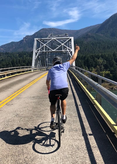
Like many trails in the Gorge, this 9-mile loop is part of the Old Columbia River Highway. Cars are banished from this part, thankfully, and the old tunnels are fun. Start at the Mark O. Hatfield West Trailhead (stateparks.oregon.gov) east of Hood River (parking, restrooms) and head east. You’ll gain 300 feet of altitude. Turn around east of Mosier, return along the same path, proceed to pFriem Family Brewers (pfriembeer.com) in Hood River, drink beer, and reward your children with fries and root beer so they learn to love cycling.
Oldman Pass
This route cannot be ridden in footie pajamas. Nor do you want to tow any offspring. Decide how much you want to suffer before choosing your starting point. I prefer to begin at the Carson National Fish Hatchery (fws.gov/fish-hatchery/carson) 17 miles north of Carson, Wash.
Head north and keep right at the fork to stay on Wind River Road. Things are pretty chill for the first 6 miles. It’s uphill, and the pavement is a little rough, but your heart won’t leap out of your chest, yet. The real climb starts at the Paradise Creek Campground. From there, you head pretty much straight up. The air cools, the trees gather more moss, the corners get sharper, and the grade hits Italian Alps percentages. The whole ride is only 11 miles, but it will feel longer because you gain 2,100 feet in elevation, most of it in the second half.
After you catch your breath at the Oldman Pass Sno-Park (restroom, flat spot to lie down and question your choices), you can keep going down the other side and hang a left in 2 miles on Cully Creek Road. Descend another 2 miles, and you reach McClellan Viewpoint, where, on a clear day, Mount St. Helens feels close enough to reach out and touch.
Return the same way, stopping at the top of Oldman Pass to put on something windproof, because you’re going to fly down the other side. The only thing holding you back, speedwise, is your sense of self-preservation and RVs. Strava tells me I hit 50 mph here, regularly. Traffic is light, even at the height of summer, so you can let it rip.
Larch Mountain
On a climb closer to home, Larch Mountain will give you quads of steel. Again, your starting point determines how much you suffer on the uphill. For a longer ride, start in downtown Troutdale (cute main street, food, ice cream, iron sculptures) and head south along the Sandy River on the Old Columbia River Highway (they let cars on this part, dammit).

Climb 6 miles to Corbett, then another 1.6 miles to the Portland Women’s Forum State Scenic Viewpoint (a totally respectable place to start). From here, the traffic thins out, and you begin to ascend through Douglas fir forests. Settle in, because you have 14 miles of climbing, and it gets steeper the closer you get to the top.
The payoff, after a short hike to the viewpoint, is a spectacular view of Wy’East (a way better name than Mount Hood and one that captures its majesty).
The other reward is a 21-mile downhill speed test to the Sugarpine Drive-In, where you can order the waffle grilled cheese and the largest soft serve sundae with chocolate brownie bites, hazelnut brickle, and—go for it—gummy bears because you just biked your ass off.
This story is part of Oregon Summer Magazine, Willamette Week’s annual guide to the summer months, this year focused along the Columbia River. It is free and can be found all over Portland beginning Monday, July 1st, 2024. Find a copy at one of the locations noted on this map before they all get picked up! Read more from Oregon Summer magazine online here.


